Kharimat Khor Al Manahil
and Khor Al Manahil
|
|
|
|
|
 Department of Museums
& Antiquities,
Department of Museums
& Antiquities,
National Council for Culture Arts & Letters, NCCAL, Kuwait
|
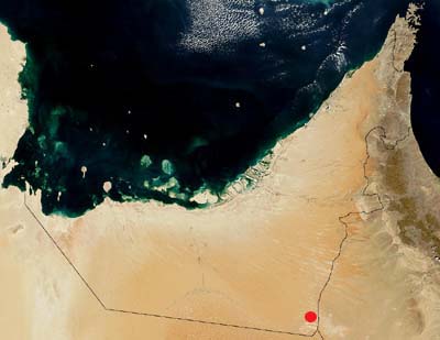
Location of Kharimat
Khor Al Manahil (Source: ADIAS)
Introduction
Initial Reconnaisance (3 - 4 November 2003)
First Season (24 January - 6 February 2004)
Second Season (29 December 2004 - 23 January 2005)
Film clips (2005 season)
Pictures (2005 season)
Third Season (28 December 2005 - 23 January 2006)
Links
Press
Publications
Introduction
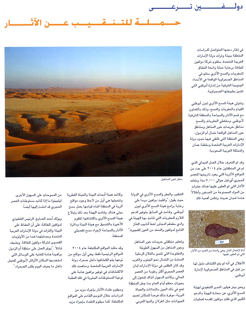
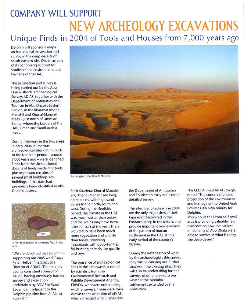
In the southeast region of the Emirate of Abu Dhabi near Umm ez Zamoul,
not far from the border between the United Arab Emirates, Oman and Saudi
Arabia a number of Neolithic sites have been recently discovered. In
several locations of this region which extends within the territory
of the U.A.E., namely to the west of the road linking Al Qua’a
with Umm ez Zamoul, around seven thousand years ago stone age people
actively practiced their daily life. The
climate in this part of Arabia at that time was different from that
of today, with more rainfall and more vegetation.
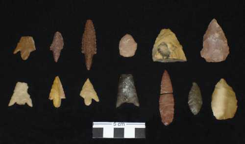
Large collections of flint tools and artefacts have been discovered
which are still under study. Arrowheads of different types are the most
recognizable tools among the collections which also include flakes and
limestone mortars. Similar artefacts are known from other regions of
the U.A.E but this is the first time that they have been located in
such an inhospitable environment and in such large quantities. Although
these artefacts came from the surface some remains of what look like
stone structures have also been identified.
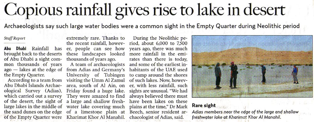
Archaeological investigations
carried out so far indicate that this region which is a desert today
was different when communities were roaming the area during Neolithic
times. Preliminary evidence also indicate that some of these sites may
have been originally located on the shores of land locked lakes that
may have existed in the region when the climate was more wet. Exposed
limestone terraces that perhaps were submerged by water do exist in
the plains which extends scores of kilometres to the west of the Al
Hajar mountains. These plains are mainly covered with sand dunes which
become higher the more they extend further to the west towards Liwa.
Two
major Neolithic settlements have been discovered in the south-eastern
desert of Abu Dhabi emirate in the United Arab Emirates. This is the
first time that stone structures, associated with extensive lithic scatters,
from this period have been discovered so deep in the interior of the
emirate. Historically the Umm ez Zamoul region has always
been a focal point because of the presence of sweet-water wells. The
area is sparsely populated and human activities at the present day are
largely confined to camel farming and related occupations, although
development of an oilfield is now under way.
Situated at the north-eastern edge of the Empty Quarter or Rub al-Khali,
the region today is characterised by flat plains interspersed with linear
mega-dunes and local patches of sabkha, some of which cover several
square kilometres.
How were the archaeological sites discovered?
A team from the Terrestrial
Environment Research Center (TERC) at the Environmental
Research and Wildlife Development Agency (ERWDA) reported in October
2003 to the Abu Dhabi Islands Archaeological Survey
(ADIAS) the discovery of a series of prehistoric lithic scatters
which they encountered whilst doing work for their Abu
Dhabi baseline survey in the south-eastern desert of Abu Dhabi emirate.
They had been working in an area called Kharimat Khor Al Manahil, located
just to the north of Umm az-Zumul.
An initial reconnaisance of the area was carried out on the 3-4 November
2003 by a small team of staff from both ADIAS and ERWDA. Shortly following
this visit, ADIAS was then provided with further information by John
Newby, Director of TERC at ERWDA, about the existence of another important
flint scatter area at Khor Al Manahil, located to the north of Kharimat
Khor Al Manahil.
Dr Mark Beech subsequently informed Dr Walid Yasin al-Tikriti (Department
of Antiquities and Tourism in the Diwan of the Ruler's Representative
in the Eastern Region of Abu Dhabi) about the new archaeological
sites discovered in this region, and a decision was made to undertake
a joint project to investigate this region by the Abu Dhabi Islands
Archaeological Survey (ADIAS) in collaboration with the Department of
Antiquities and Tourism in Al Ain.
The first season of work at Kharimat Khor Al Manahil and Khor Al Manahil
took place between the 24th January and the 6th February 2004. A second
season of work was carried out at both sites between the 29th December
2004 and the 23rd January 2005. A third season of fieldwork is currently
underway at Khor Al Manahil. This began on 28 December 2005 and is planned
until 23 January 2006.
More details are provided below.
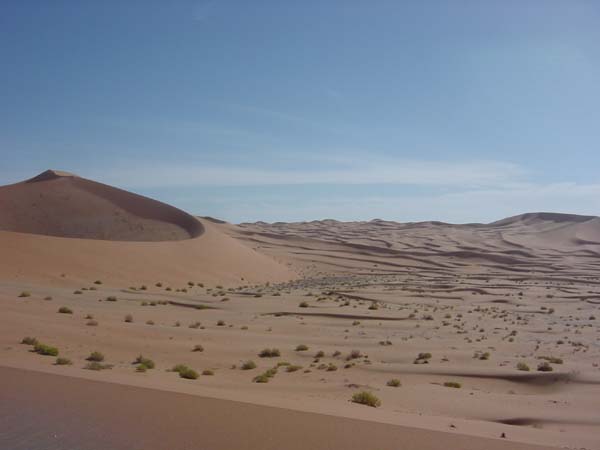
View of dunes in the area of Kharimat
Khor Al Manahil (Photograph by Dr Mark Beech)
Initial Reconnaisance
(3 - 4 November 2003)
The team on the initial reconnaisance trip comprised Dr Mark Beech and
Dr John Stewart (ADIAS), Chris Drew (TERC Mammalian Ecology Scientist),
and Dominique Pauli (TERC placement student). This work aimed to document
the precise location and extent of the lithic scatters, and to plan
a future strategy for their detailed investigation. GPS co-ordinates
were taken of a number of important sites requiring further work.
Here are some pictures taken during the fieldwork at Kharimat Khor Al
Manahil.
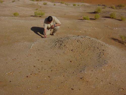
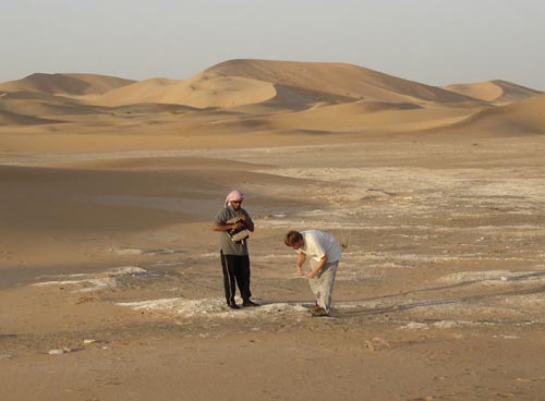
Dominique Pauli examines one of the lithic scatters
at Kharimat Khor Al Manahil
(Photograph by Dr Mark Beech)
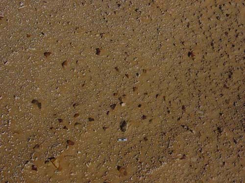
Close-up
of one of the lithic scatters at Kharimat
Khor Al Manahil (Photograph by Dr Mark Beech)
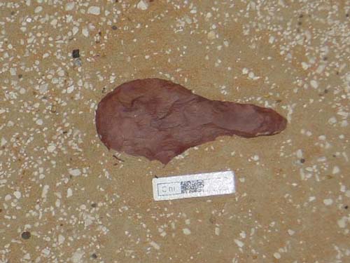
A flint
"hoe" discovered at Kharimat
Khor Al Manahil (Photograph by Dr Mark Beech)
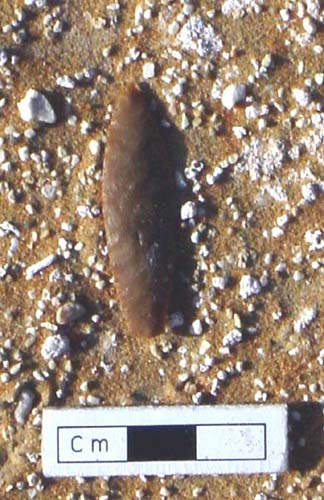
A flint
arrowhead discovered at Kharimat
Khor Al Manahil (Photograph by Dr Mark Beech)
First
Season (24 January - 6 February 2004)
The
team for this first full season of investigation of the region comprised:
Dr Mark Beech (ADIAS Senior Resident Archaeologist), Dr Heiko Kallweit
(ADIAS Associate, Freiburg, Germany), and Dr Walid Yasin al-Tikriti
(Department of Antiquities and Tourism, Al Ain).
Work concentrated in three
areas: Kharimat Khor Al Manahil (KHM), Sabkhat Bu Dab (SBD) and Khor
Al Manahil (KAM). Lithic scatters first noted at KHM by a team from
the Terrestrial
Environment Research Centre (TERC) of the Environmental
Research and Wildlife Development Agency (ERWDA) were revisited
and then systematic mapping and collection of material was made.
Mapping was undertaken of
a total of 80 sites where there were significant clusters of worked
flint and other stone material. In the KHM region these lithic scatters
were spread almost continuously along the northern edge of the plain
for more than 3km!
Two significant flint scatters at sites KHM0012 and KHM0035 were mapped
and systematically collected. This is the first time that in situ
flint scatters have been recorded in such detail in the UAE. It will
provide much important information on the technology and processes used
in the manufacture of stone tools during the Neolithic period.
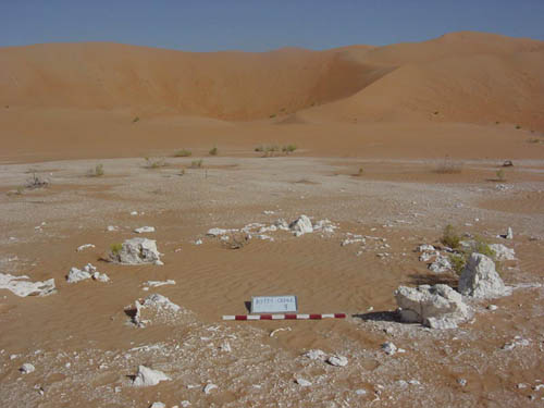
One area of particular interest
that requires further detailed investigation was identified in the Kharimat
Khor Al Manahil area (sites KHM002-4). This was a large oval depression
ca 120 x 50 metres in size. Nearly all of the flints noted here were
collected from the terraced edge around this depression. It is tempting
to speculate that the depression itself may originally have been a small
water pool or lake around 6-7000 years ago, when the climate was significantly
wetter than it is today. This, however, requires further geomorphological
work and testing of sediment samples in the future.
The most exciting result
of the first season was the discovery of two major settlement areas
with surviving stone structures. No pottery was found at any of these
sites but there were large quantities of Late Stone Age flints scattered
amongst and around the sites. A group of three adjacent stone structures
was located in the Kharimat Khor Al Manahil region (sites KHM0045-47).
These were round to oval shaped structures about 5-6metres in diameter
whose perimeter was marked by large limestone blocks. A 4x1metre test
trench was excavated through the western entrance of the best preserved
structure (KHM0046).
House structure at site KHM0046, Kharimat Khor Al Manahil
(Photograph by Dr Mark Beech)
This revealed that the east
and west aligned entrances to the structure had substantial stone blocks
set on their side, which in some cases were up to 80cm in length. The
structures were built directly onto a silty sand matrix, and the blocks
of stone had clearly been transported to the site, perhaps from the
limestone outcrop located about 1.5km to the east.
A second settlement area was also noted 7km to the NE at Khor Al Manahil.
Here the structures were more eroded but there appeared to be a cluster
of at least five possible structures (KAM003-7).
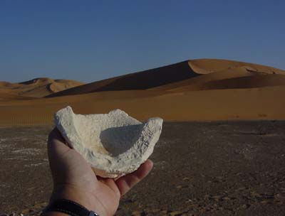
Limestone mortar discovered at site KAM008, Khor Al Manahil
(Photograph by
Dr Mark Beech)
Two limestone mortars (one of them is depicted above) were discovered
on the ground surface adjacent to the structures at Khor Al Manahil.
Some quite remarkable stone tool artefacts were recorded at the site
including this fine willowleaf foliate.
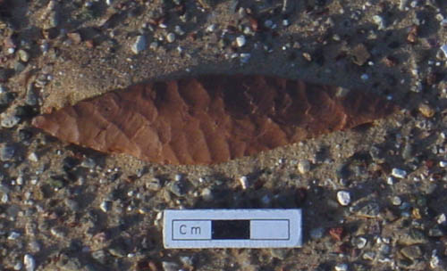
Willowleaf foliate from site KAM009, Khor Al Manahil
(Photograph by
Dr Mark Beech)
Second
Season (29 December 2004 - 23 January 2005)
A second season of work at Khor Al Manahil and Kharimat Khor Al Manahil
took place from late December 2004 to late January 2005. The team comprised
Dr Mark Beech (ADIAS Senior Resident Archaeologist), Richard Cuttler
(ADIAS Associate, Birmingham Archaeology, University of Birmingham,
UK), Dr Heiko Kallweit (ADIAS Associate, Freiburg, Germany), Hamed Al
Mutairi (Department of Museums and Antiquities, National Council for
Culture Arts and Letters, NCCAL, Kuwait), and Dr Walid Yasin Al-Tikriti
(Department of Antiquities and Tourism, Al Ain).
Additional field assistance for was provided for a few days by Dr Drew
Gardner (Zayed University, Abu Dhabi), Marc Dyer (Petroleum Institute,
Abu Dhabi) and Karen Cooper.
The main focus of work for the second season was concentrated on the
sites located in the Khor Al Manahil area. Some work was also carried
out towards the end of the season in the Kharimat Khor Al Manahil area.
The main aims of the 2005
season were as follows:
(1) to map the extent of
the archaeological sites at Khor Al Manahil, sites KAM0001 - KAM0021.
(2) to systematically pick-up and map all lithic material from the Khor
Al Manahil sites.
(3) to make a topographic map of the terrain at Khor Al Manahil so that
the archaeological sites could be seen precisely within their landscape
context.
(4) to make a topographic map of the terrain at site KHM0035, the rich
lithics scatter first investigated during the 2004 season, so that the
archaeological site could be seen precisely within its landscape context.
(5) to map the extent of the three stone structures, sites KHM0045 -
KHM0047, at Kharimat Khor Al Manahil.
(6) to make a topographic map of the terrain surrounding sites KHM0045
- KHM0047 so that the archaeological sites could be seen precisely within
their landscape context.
For the purposes of the survey
a Nikon C100 with a data logger using Fast Map FM700 logging software
was used. Local grid coordinates were used from stations which were
fixed to national coordinates using a hand-held GPS. The survey comprised
a 3D record of the location of each find collected plus a survey of
the local topography in order to place the flint within its current
topographic location. This also served to illustrate current dunes where
no flints were recovered. Clearly this is important as these have the
potential to mask areas of flint, and thereby explain any areas absent
of debitage within the site.
As each find was collected
an incremented number, provided by the logger, was used as the survey
reference number for each find. The extents of rubble spreads were also
located at Khor Al Manahil, and the extents of structural elements at
Kharimat Khor Al Manahil. To date the data has been processed using
Geosite software which has provided a location plan of each find, plus
a contour survey of the topography. This has also been processed in
AutoCAD 2004 to provide a Digital Terrain Model. Once the lithic database
is completed this will be combined with the topographic survey and exported
to a GIS program (most probably ArcView). This will enable the presentation
of different flint types within the topography of the site.
Here are two film clips taken during the second season:
 to download a tour of the Khor Al Manahil site with commentary by Dr
Mark Beech click here - MPG format 2.46
MB
to download a tour of the Khor Al Manahil site with commentary by Dr
Mark Beech click here - MPG format 2.46
MB
to download a tour of our camp site at Khor Al Manahil complete with
visiting camels click here - MPG format
7.48 MB
Here are some pictures taken during the second season:
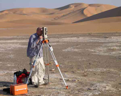
Richard
Cuttler (Birmingham Archaeology) surveying at Khor Al Manahil
(Photograph by Dr
Mark Beech)
Hamed
Al-Mutairi and Dr Heiko Kallweit at Khor Al Manahil
(Photograph by Dr
Mark Beech)
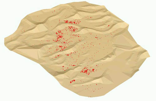
Rendered
visual of the lithics scatter at Khor Al Manahil showing the location
of individual lithic pieces (red dots) in relation to the flat plains
and sand dunes (Copyright: ADIAS)
Selection
of flint artefacts from Khor Al Manahil (Photograph
by Dr Mark Beech)
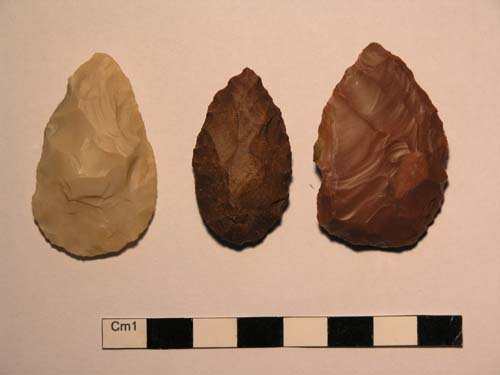
Selection
of flint artefacts from Khor Al Manahil (Photograph
by Hamed Al-Mutairi)
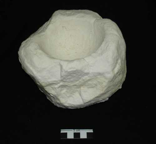
Limestone
mortar from Khor Al Manahil (Photograph
by Dr Mark Beech)
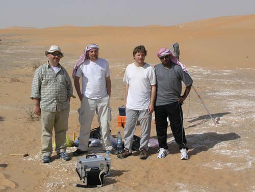
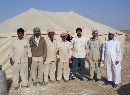
From
left to right: Dr Mark Beech, Richard Cuttler, Dr Heiko Kallweit and
Hamed Al-Mutairi at Khor Al Manahil
Mohammed
Sami (extreme left), our cook, and members of the Department of Antiquities
and Tourism, Al Ain, who helped to establish the camp at Khor Al Manahil
(Photograph by Dr
Mark Beech)
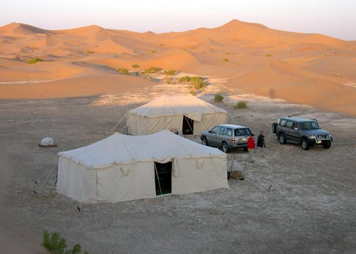
Our
camp at Khor Al Manahil (Photograph
by Dr Drew Gardner)

Some
camels who came to visit our camp at Khor Al Manahil
(Photograph by Dr
Mark Beech)
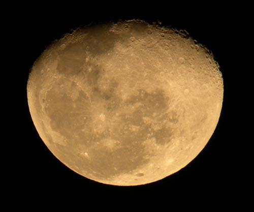
The
Moon as viewed from our camp at Khor Al Manahil on 30 December 2004
(Photographed using
a digital camera held manually against a telescope by Dr Drew Gardner)
Third
Season (28 December 2005 - 23 January 2006)
An ADIAS team is currently working at Khor Al
Manahil in the Umm az-Zamul region of South-East Abu Dhabi. This
is a joint project of the Abu Dhabi Islands Archaeological Survey (ADIAS),
in collaboration with the Department of Antiquities and Tourism in Al
Ain. The work is investigating Late Stone Age Neolithic sites discovered
in this area. The team is comprised as follows:
Co-directors: Dr Mark Beech (ADIAS Senior Resident Archaeologist), Dr
Heiko Kallweit (ADIAS associate and Freiburg, Germany) and Dr Walid
Yasin Al-Tikriti (Department of Antiquities and Tourism, Al Ain).
Team members: Richard
Cuttler (ADIAS associate and Birmingham Archaeology, University of Birmingham,
UK), Suzan Al Mutawa (ADIAS researcher), Phil Glover (ADIAS associate,
Abu Dhabi), Hamed Al-Mutairi (Department of Museums and Antiquities,
National Council for Culture, Arts & Letters, Kuwait) and Ahmed
Abdullah Elhaj (Department of Antiquities and Tourism, Al Ain).
Work is concentrated on completing the pick-up of flints from the
Khor Al Manahil site, as well as the mapping and excavation of three
burnt mound features.
Links
Across
The Rub 'Al-Khali by Elizabeth Monroe - article in Saudi Aramco World
magazine, Vol. 24/6, Nov/Dec 1973.
Arabia:
Sand, Sea & Sky by John Lawton and Miranda McQuitty - article
in Saudi Aramco World magazine, Vol. 41/3, May/June 1993.
Are
you an entrepid desert explorer? - part of the Explore Saudi Arabia
website.
Camping
In The Empty Quarter by Brainerd S. Bates - article in Saudi Aramco
World magazine, Vol.18/6, Nov/Dec 1967.
Crossing
the Rub' by Erik A. Mandaville - article in Saudi Aramco World magazine,
Vol.40/3, May/June 1989.
Empty
Quarter - Exploring Arabia's Legendary Sea of Sand by Donovan Webster
- National Geographic Magazine.
The
Empty Quarter by George Steinmetz - National Geographic Magazine -
nice film clips about the Empty Quarter.
Lakes
of the Rub' al-Khali by Arthur Clark - article in Saudi Aramco World
magazine, Vol. 40/3, May/June 1989.
Proposal
to Establish The Umm Al Zummoul National Park [ pdf 829KB ] by C.
Drew, I. Barcelo, S. Al Dhaheri, A. Al Hemeri and C. Tourenq. 2005. ERWDA
Internal report 03-31-0002/WSM/TP. ERWDA, Abu Dhabi, UAE.
Technical report from the Terrestrial Environment Research Centre from
the Environment Agency - Abu Dhabi. The purpose of this document is to
present a strong and well researched proposal for the establishment of
the Umm Al Zummoul National Park.
Satellite
image of Umm az-Zumul - 2 October 1994 (Source: Deutschen
Zentrum für Luft- und Raumfahrt DLR - German Aerospace Centre)
Umm
ez Zamoul - summary of the results of recent archaeological work -
part of the Al Ain Department
of Antiquities and Tourism website.
Umm
al-Zumul (Source: Arabian
Wildlife)
Press
16 September 2003
Erwda
plans to build network of protected areas (Source: Khaleej
Times)
12 March
2005
Lakes
in the desert (Source: WAM Emirates News
Agency)
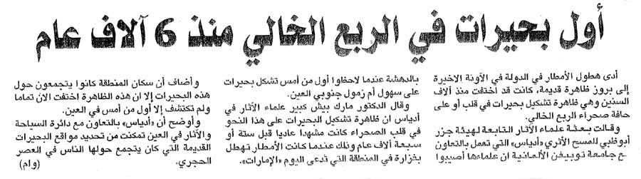
13 March 2005
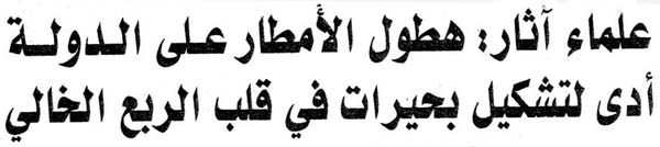
Lakes
in the desert - in arabic [ also download jpeg
version ] (Source: Al Ittihad)
Now,
lakes in the desert! (Source: Khaleej
Times)
Lakes
in the desert (Source: UAEinteract.com)
Lakes in the desert
- in arabic (Source: Akhbar Al Arab)

Lakes in the desert - in
arabic (Source: Al Bayan)

Lakes in the desert - in arabic (Source: Al
Ittihad)

Lakes in the desert - in arabic (Source: Al
Khaleej)
14 March 2005
Copious
rainfall gives rise to lake in desert [ also download jpeg
version ] (Source: Gulf News)
15
March 2005
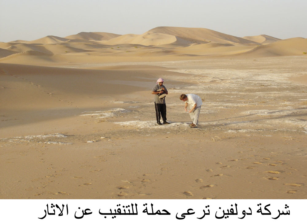
Click on these thumbnails for larger versions of the pictures:

Archaeological
work at Khor Al Manahil |
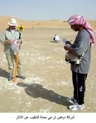 Archaeological
work at Khor Al Manahil
Archaeological
work at Khor Al Manahil |
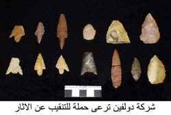 7000-year-old
flint tools from Khor Al Manahil
7000-year-old
flint tools from Khor Al Manahil |
Dolphin
to support new archaeology excavations (Source: WAM
Emirates News Agency)
16 March
2005
Dolphin
to support new archaeology excavations (Source: UAEinteract.com)

New Archaeology
Excavations - Unique finds in 2004 of Tools and Houses from 7,000 years
ago [ download english
or arabic
version ] (Source: Dolphin
Insight - Newsletter of Dolphin
Energy Ltd.)
Publications
The results of
the work carried out to date were presented in a joint paper written
by Dr Heiko Kallweit, Dr Mark Beech and Dr Walid Yasin Al-Tikriti at
the Seminar for Arabian Studies
conference, held at the British
Museum in London in July 2004. This paper was published in the Proceedings
of the Seminar for Arabian Studies volume 35 (2005).
Kallweit H., Beech M. &
Al-Tikriti W.Y. 2005. Kharimat Khor al-Manahil and Khor Al Manahil —
New Neolithic sites in the south-eastern desert of the UAE. Proceedings
of the Seminar for Arabian Studies 35: 97-113.
[ to
download this article in Acrobat .pdf format click here (6.87 MB) ] .
Some other related publications of interest are:
Drew, C., I. Barcelo, S. Al
Dhaheri, A. Al Hemeri and C. Tourenq. 2005. A Proposal to establish
the Umm Al Zummoul National Park. ERWDA Internal report 03-31-0002/WSM/TP.
ERWDA, Abu Dhabi, UAE.
[ to download this article in Acrobat .pdf format click
here (829
Kb) ] .
Kallweit H. 2003. Remarks
on the Late Stone Age in the U.A.E. Pages 55-64 in D.T. Potts, H. Naboodah
& P. Hellyer (eds.), Archaeology of the United Arab Emirates: Proceedings
of the First International Conference on the Archaeology of the UAE.
London: Trident Press.
Uerpmann H-P. and M. Uerpmann.
2003. Stone Age Sites and their Natural Environment - The Capital Area
of Northern Oman Part III, with a contribution by Stefan Scholer. Beihefte
zum Tubinger Atlas des Vorderen Orients - Reihe A (Naturwissenschaften)
Nr. 31/3. Dr Ludwig Reichert, Wiesbaden, Germany.
home
|


